Most of the illustration I do involves scribbling with a pen on paper, but not all.
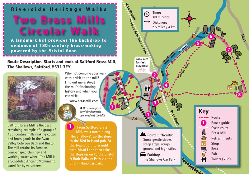
Just for a change, I thought I’d post some walking maps I worked on with Environmental Education and Interpretation Specialist Ruth Coleman last year.
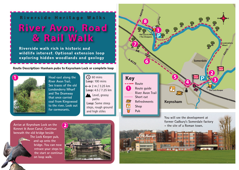
This involved lots of sitting in front of a computer but also a certain amount of getting lost and stung by nettles.
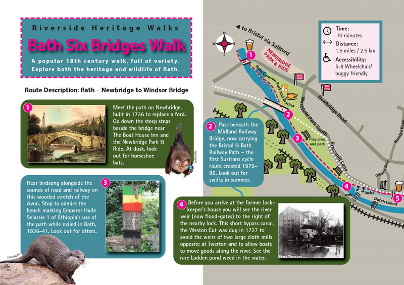
The maps were produced by the WaterSpace Project, a partnership between B&NES Council, the Canal and River Trust, the Environment Agency and Wessex Water in collaboration with The Bath Mayor’s Guides, the Kennet & Avon Canal Trust, the Avon Frome Partnership and Mike Chapman.
If you fancy a walk this half term, you can download all three maps on this page of the River Avon Trail website.